
Note: I’ll be keeping this post stuck to the top and updating it until we’ve weathered the storm.
I’ll try to keep you updated with the latest Southborough information, so be sure to check back. (You can also follow me on Twitter and Facebook.)
Refresh your browser to see the latest updates. The most recent news will be at the top.
For other stories posted today, scroll down.
![]()
Updated (1/28/15 8:40 am): It looks pretty calm out there. And our street is clear. Thanks to all of our emergency personnel and the DPW crews for their hard work through the blizzard!
Once again, Town offices open at 10:00 am today.
NWS is predicting another bit of snowfall Thursday night – but it’s not much. They project a 70% chance of 1-3 inches of snow, ending before 9:00 am Friday morning.
Remember, SEMA is asking people to make sure their hydrants are clear – plus any of your exhaust pipes or vents.
I can’t find any official snowfall totals yet for Southborough. So, if you’ve seen it – please share. And if anyone has pictures they want to share, send them to mysouthborough@gmail.com.
I’ll be moving this story “down” from the top with my next regular post this morning. Those of you with school kids – enjoy the extra day home with them!
![]()
Updated (1/27/15 7:15 pm): I missed an earlier message from Southborough Emergency Management.
While the travel ban lifts at midnight, SEMA is asking people to try to stay off the roads as the state and Town state of emergencies will remain in effect until further notice.
SEMA warns:
While the storm is moving out of the area, winds causing blowing/drifting snow with near whiteout conditions will continue through early Wednesday. If you do not need to drive please stay off the roads for safety and to allow plow crews to catch up, especially on side roads.
Be sure to clear out (and monitor for additional clearing due to snow drifts):
- All exterior doorway exits/egresses
- All exterior vent exhaust pipes, especially low direct-vent heating unit vents. It is recommended to us a professional for and roof clearing
- Fire Hydrants near your home or business. 4’ x 4’ on all sides (thank you)
- Any neighbors or family, especially elderly
![]()
Updated (1/27/15 6:49 pm): An isolated power outage affecting only a few people was reported this evening. Estimated restoration by 10:15 pm.
![]()
Updated (1/27/15 6:45 pm): Town offices delayed opening until 10:00 am. On Wednesday.
![]()
Updated (1/27/15 6:35 pm): Can’t resist sharing this tweet by Southborough News:
Southborough taken in least windprone area of yard pic.twitter.com/vzzARtR8QF
— Southborough News (@Southboronews) January 27, 2015
How deep is it in your yard? (NWS advises measuring in a few spots and averaging.)
![]()
Updated (1/27/15 6:30 pm): The travel ban will be lifted as of midnight. MBTA (including commuter rail) will be back to work on Wednesday.
Still no word on whether town offices will be open or delayed tomorrow.
![]()
Updated (1/27/15 1:57 pm): Southborough and Northborough public schools, and Assabet Valley Regional Technical School have announced that schools will be closed tomorrow and after school activities cancelled. This is due to anticipated road conditions.
Massachusetts Emergency Management officially released the updated travel ban I referred to in my last update. (Click here to read.) Still no news on when they expect it to be lifted in our region.
Those of you who were disappointed not to get your Metrowest Daily News delivered today may be happy to know that the electronic version is available free to everyone online today. Click here.
I checked it out, and there was a nice piece explaining why no blizzard compares to the infamous Blizzard of ’78.
If you like that, you might also like this post with comments that Susan ran two years ago. She encouraged readers to share their memories of that storm’s impact on Southborough.
(Thanks to Southboroughnews.com for the heads up on AVRT’s closing!)
![]()
Updated (1/27/15 12:38 pm): Governor lifting travel ban in some counties, but not ours. Worcester County is still in area locked down.
Changes have yet to be posted online by Governors office but reporters at NECN have been tweeting. Apparently, the Governor is lifting the ban for Berkshire, Hamden, Hampshire, Franklin counties,where snow is manageable. The ban continues to apply for I-90 and east of Worcester, where storm is more severe.
![]()
Updated (1/27/15 8:55 am): Earlier, National Grid reported a Southborough outage this morning affecting 7 homes. But a few minutes ago, that changed to 0 – beating their estimated restoration time for 10:45 this morning.
NWS’ updated forecast this morning brings today’s snow accumulation down a couple of inches, (but I don’t know how we fared vs last night’s projected snowfall.)
![]()
Updated (1/26/15 6:00 pm): NWS’ updated forecast this afternoon brings the high range for us down by 10″. (Phew! Let’s hope that trend continues.)
So, updated range from NWS is about 20-27″. (Click here for their forecast.)
And, once again, SEMA’s local expert had low end of range at 15″ in his forecast written Sunday morning. (Let’s hope his is the more accurate.)
![]()
Updated (1/26/15 5:40 pm): The storm’s been officially classified a State of Emergency, meaning only essential emergency and medical personnel should be traveling during the storm. In Boston the snow emergency begins at 6:00 pm.
A statewide travel ban goes into effect at midnight.
Once again, we aren’t in the prime zone for power outages – but isolated ones are possible. Governor Baker warned that it could take several days for all power outages to be restored.
![]()
Updated (1/26/15 2:51 pm): Southborough Public Schools, Northborough, and Fay School have all announced they will be closed on Tuesday. (Everyone’s waiting to see before making a call on whether school will be open Wednesday.)
As I noted in my Week in Government post this afternoon, all public meetings scheduled for tonight and tomorrow had already been cancelled.
Reminder: The Town’s annual winter parking ban means no parking on the street any time of day during snow events. (Violaters will be towed at their own expense.)
![]()

Above: National Weather Service forecasts from this morning. Click to enlarge.
As I’m sure you’re aware by now, a major blizzard is forecast to begin tonight. (Though, we may start seeing some flakes this afternoon.)
Southborough Emergency Management Agency’s local weather specialist wrote:
This storm is the real deal, and has the potential to turn out to be one of the historic storm events of our lifetime, even rivaling the Blizzard of 1978.
How much snow where going to get is still up in the air. But it’s bound to be a lot. So, make sure your prepared for worst case scenarios.
The schools haven’t sent out an official cancellation yet. But SEMA, which helps them make that call, shared this morning, “School will most likely be canceled Tuesday and Wednesday (and possibly Thursday).”
And Southborough Recreation has already cancelled their after school RAP programs for today.
I have two very different forecasts for tomorrow. Neither is good.
SEMA’s expert calls for 15-25 inches of light, powdery snow. That comes with sustained 15-35 mph winds and gusts up to 50 mph. High temperature of 18f. (That forecast is from Sunday morning with qualifier that conditions could change.)
That was the better forecast. The National Weather Service paints a bleaker picture.
As of this morning, NWS’ maps Southborough in an area looking at 27-33″. And their detailed forecast put us at up to 37″ by Wednesday morning. NWS forecast a lot of “blowing snow”, but warned snow may be heavy at times throughout the storm. That comes with 18-21 mph winds and gusts of 35-47 mph. High of 18f with wind chill values as low as zero degrees. (Click here to see NWS’ updated, detailed forecast.)
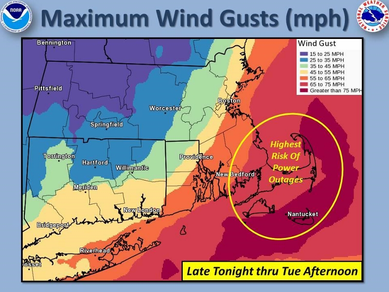
At least we’re not in the area with highest probability of power outages. But that doesn’t mean you shouldn’t be prepared for one.
Below is more information from SEMA:
Impacts:
Snow
- Accumulations between 15-25+” (subject to change)
- Light, Powdery
- Falling rates of 1” to 4” per hour
Wind:
- Sustained: 15-35 mph
- Gusts: 50 mph (80 – 90 mph on the outer Cape)
- Monday: ~ 15 sustained
- Tuesday: ~ 35 sustained
- Wednesday: ~ 15 sustained
Temperatures: (ambient – not factoring wind chills)
- Monday: High 25f / Low 15f
- Tuesday: High 18f / Low 14f
- Wednesday: High: 24f / Low 10f
Hazards:
Visibility:
- Decreases viability (for several days) including “whiteout conditions” due to:
- Snowfall rates
- Blowing & drifting snow
Driving/Walking Hazardous due to:
- Snowfall accumulation rates on roads – Plows will NOT be able to keep up at times
- Visibility, leading to accidents and becoming disoriented and/or lost
- Health (breathing, frostbite, hypothermia) due to wind chill temperatures
Power Outages
- Isolated with moderate to low potential
Snowdrifts – Blocking (& re-blocking over several days):
- Visibility Driving & Walking especially at intersections
- Home/building egress and exits (walkways, Driveways, Doors)
- External Home vents, especially low to ground heating system vents
Preparedness/Actions:
Take step to prepare as individuals, families and businesses starting TODAY
- Have adequate:
- Home heating oil/propane, Gasoline for Generators/Snow blowers/etc
- Flashlights & Batteries (DO NOT use candles on any kind)
- Food/Water/Medications
- Check your smoke and Carbon Monoxide Detectors are working
- Have a communications Plan with Family & Neighbors
- Make plans, if possible, to work from home on Tuesday (and possibly Wednesday)
- School will most likely be canceled Tuesday and Wednesday (and possibly Thursday)
- DO NOT go out during the storm (walking or driving) unless absolutely necessary
- If you must venture out (even to the mailbox):
- Dress properly
- Notify someone where you are going and when to expect you back
- If you must venture out (even to the mailbox):
- Always carry a fully charged cell phone
- Check in on elderly family, friends & neighbors
- Use extreme caution operating space heaters (etc.) and never leave unattended or overload electrical outlets
- Use caution-operating equipment and NEVER run generators/cars/etc. inside a garage/basement or near a house vent.
- Never sit in a running vehicle without the windows open AND continuously ensure the exhaust pipe is clear of snow
- Continuously check that external home exhaust vents are clear of snow, especially heating system vents low to the ground.
- PLEASE help clear fire hydrants (4’ x 4’) near you homes/businesses

Beth:
I saw a note that mail & UPS shut down in some areas.
Can you confirm shipping companies’ status for Southborough?
Thanks!
The Governor declared a statewide travel ban. So don’t expect any UPS deliveries today!
There are exceptions to the travel ban – but post office and delivery companies aren’t listed among them. It’s more geared to allowing emergency personnel and vital workers do their jobs.
And while exceptions include gas station and supermarket workers – I doubt you’ll have luck finding those open today.
For the travel ban details, see http://www.mass.gov/alert/alertlanding.html#2136439
Don’t forget to clear your sidewalks! Especially for those trying to the train station tomorrow morning!
I have to share another kudos for the DPW. I just confirmed that the Transfer Station is open today. I’m sure getting that cleared was no small effort!