
Southborough Emergency Management’s Lt. Neil Aspesi is sharing another New England weather warning.
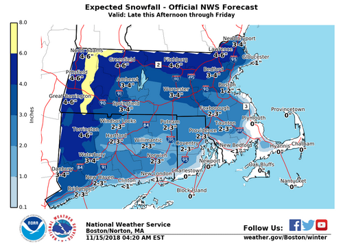
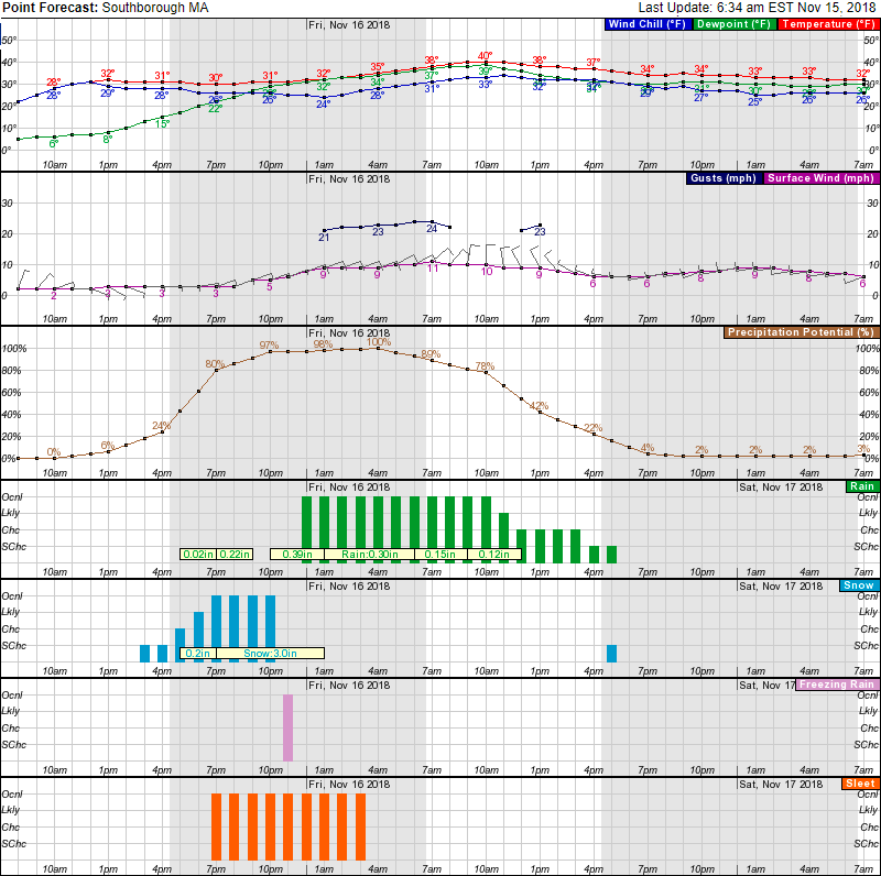
His message notes that the forecast is likely to change, so keep an eye on local weather. Since his warning was written yesterday, I didn’t include the attached National Weather Service forecast. Instead, I’m sharing the updated maps and charts they generated early this morning. Those indicate 3-4″ of snow expected tonight. There is a high likelihood of that starting by or before 6 pm.
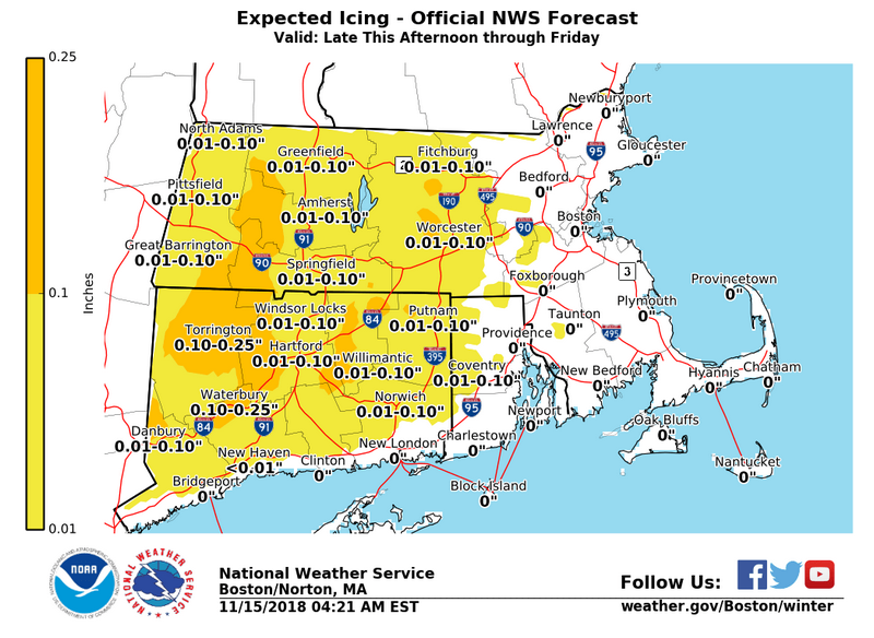
I wouldn’t make plans to go out tonight. The snow and rain are expected to overlap with sleet. So expect sloppy roads tonight and possible icing in the morning.
According to Aspesi’s warning, so many leaves already down will reduce chance of downed trees and limbs. But the leaves on the ground can block drainage. That means higher chance of flooding.
Here are the NWS graphics (click to enlarge), followed by Aspesi’s warning:

We are looking at a mix bag of precipitation and winds Thursday afternoon through Friday. The type and duration of precipitation we receive will be dictated by both the temperatures aloft and at ground level. It is difficult to determine when exactly precipitation will transition from wintery to all rain. The worst case scenario would be an extended period of freezing rain overnight, catching people off guard Friday morning.
Currently our area is looking at:
- 2-3” of snow
- A very short period of freezing rain with minimal accretion
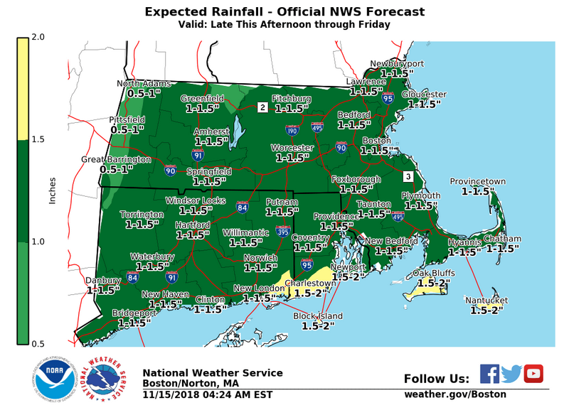
- 1-1.5” of rain
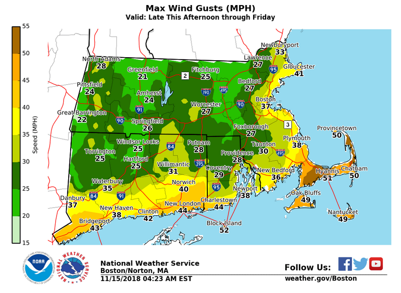
- Wind gusts 25-30mph.
This event presents the unique challenges of:
1. Occurring during the Thursday evening commute (and possibly Friday Morning – but currently looks like rain by then)
2. The first winter driving challenge for drivers, which always seems to be an issue
3. Extremely high water tables, resulting in quicker than normal flooding (also compounded by drainage blocked by fallen leaves)
4. Ground saturation, resulting in a higher potential for downed trees / power outages (the lack of leaves in the trees will help reduce this risk)
Below and attached is info form the National Weather Service Boston/Norton. This information IS NOT an official forecast – is ONLY designed to assist in preparedness decision making.
Last two things I can say:
1. This forecast WILL change to some degree before precipitation starts – so be sure to stay tuned to local forecast (news, web, apps) updates
2. Please use caution walking and driving – especially if we get freezing rain – which can turn everything slick in a matter of minutes.
Be Smart, Be Safe,
Lt. Neal P. Aspesi
Southborough Fire Department
Southborough Emergency Management
