
I recently came across this map from the Boston Public Library’s Norman B. Leventhal Map Center, that shows what Cordaville and Southville looked like in the late 1800’s. You can see buildings that are still standing today like St. Matthew and First Community churches. Also prominent is the Cordaville Cotton and Woolen Mill at the site of the current MBTA station.
Click the image below to enlarge it, or visit the map center for an interactive version.
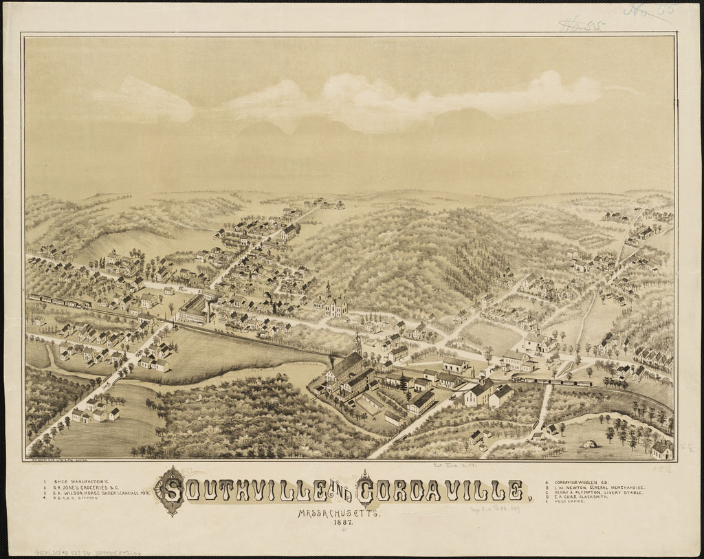

Thanks Susan! Does anyone know what the building at the corner of Parkerville & Southville (Also Highland and Bridge Street) used to be?
Good question, Emily. I was wondering that myself.
The train station I believe
That’s one big train station. Maybe it’s the perspective, but it looks as big as the mill buildings. Southborough must have been quite the destination back then!
An observant reader (hi, Mom!) pointed out that there’s a legend at the bottom of the map that identifies some of the buildings. According to the legend, the big building on Southville Road at Parkerville was a shoe manufacturer. The train station is a smaller building kitty-corner to that larger one.
The Southborough Historical Society website says that by 1850, Southborough boasted six boot and shoe factories, along with six grist mills, three saw mills, three cotton and wool factories, three tanneries, two brick kilns, a brush factory, a wire factory, a peg mill, a flour mill, one currier shop, a bonnet factory, a carriage factory, and a cordage factory. Who knew?
the train station used to be on the south side of the tracks “kitty corner” as was said above, but was later moved and turned around and put down in its present location at the corner of Southville Rd and Parkerville. Current owners are doing some wonderful gardens.
I LOVE old maps and can find my house on this one!
Your right about the station debbie, i was thinkin of present day opps! If i’m reading the map right, it says that big building is the shoe factory. You can see a tiny number 1 by bottom of the smoke stack.
Susan, the building you are talking about was the plaster factory. I believe they made back plasters and that sort of medical thing there. The blue house sits there now. Opposite that sits a white raised ranch that sits where the original stone train depots sat. The brown house that sits between Southville, Highland, and Parkerville used to be across the street next to the train station. It was a freight house. After it was moved it became Howard Lincoln’s store and also housed the Southville Post Office.