

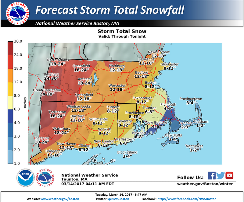
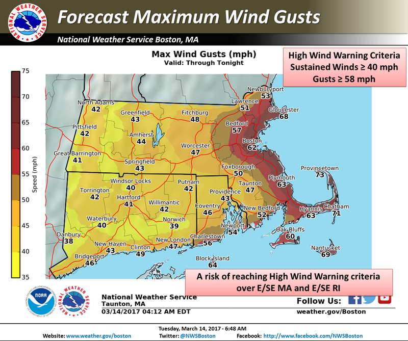
Above: The latest maps from the National Weather Service show Southborough is in definite blizzard territory, and in area with heavy & wet snow. Combine that with 12-18″ accumulation and 50 mph wind gusts – we’re looking at high potential for power outages here. (click on images to enlarge)
I have some more closings to share. (Though, none are exactly breaking news.) And Southborough Emergency Management has issued another update on our Town’s outlook. (Spoiler, it’s not good news.)
As you would expect, Town offices and the Southborough Library are closed today. Town meetings scheduled for today are cancelled. And the first session in the Lenten Series was scheduled for tonight. That will now wait until next Tuesday. (I’ll post more about that later.)
Reminder, if you want to know where to look for emergency updates, who to contact about power outages, etc – click here.
Now here’s an excerpt from the update by SEMA’s Neal Aspesi:
There have been some rather concerning developments in our storm forecast. The track has continued to move more westerly which will bring the sleet/rain mix/changeover line closer to us. As such we will experience HEAVIER & WETTER snow. This will lower snow totals to 12-14” BUT dramatically increase the threat of downed trees/limbs and powerlines with a greater potential of isolated and wide-spread power outages.
The winds will also be stronger with this new track, reaching guts of 50mph.
What has not changed is the fierceness of the snowfall rates at 2-4” per hour, with the height being between 10am and 4pm.
The combination of all these factors are SIGNIFICANT and CONCERNING, creating an even more dangerous and impactful storm than forecasted yesterday. DO NOT BE FOOLED BY THE LOWER SNOW TOTALS.
