
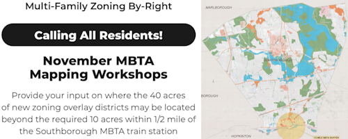
Above: If you’re concerned about where the new zoning for dense housing should be sited, you may want to join one of the sessions to help the Planning Board decide. (images cropped from flyer and map.)
The Planning Board has put out another call for residents to take part in the Town’s work on new zoning to increase “by-right” multi-family housing development options in Southborough.
To comply with the state’s MBTA Zoning regulations, the board will identify where to apply a new zoning overlay. They are asking residents to help them select where to “map” 10 acres near the train station and 40 acres beyond it.*
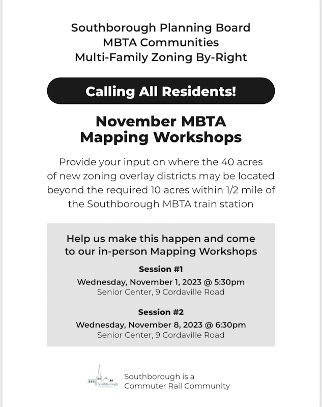 The workshops will be held the next two Wednesday evenings (November 1st at 5:30 pm and November 8th at 6:30 pm). To facilitate an interactive session, they’ll be hosted at the Southborough Senior Center/Cordaville Hall (9 Cordaville Road).
Based on the flyer, sessions will focus on the areas outside of the “dome” around the MBTA station.
[Editor’s Note: In speaking to the Planning Department, I misunderstood what they intended the flyer to convey. They are seeking feedback on all of the sections where the zoning should go, not just the “40 acres. . . beyond” the vicinity of the MBTA station.]
More Context
I previously explained that the state’s regulations stipulate that zoning should allow 15 housing units per acre on over 50 unrestricted acres, including 10 acres within a 1/2 mile of the commuter rail station on our southern border. (The parcels can be broken into multiple areas, but none smaller than 5 contiguous acres.)
[Editor’s Note: At their December 11th meeting, Planning members said that the restrictions also require at least one parcel cover 25 contiguous acres.]**
But there are other details I haven’t shared yet that are worth highlighting. Some are from the presentation and Q&A at last month’s public forums, some are from my own research and private Q&A following up on the forums, and other public meetings.
I’m also highlighting some of residents expressed (and likely) concerns.
Required Approvals
The board isn’t the ultimate authority on the zoning overlay. Whatever they choose must be approved by Town Meeting voters. But under the state law, that only requires a simple majority for this initiative (not the usual 2/3 for zoning changes).
That does make it easier to pass. But it is still unlikely if there is one or more neighborhood deeply opposed to zoning changes on their streets. That makes public participation in the decision critical.
The map must also pass muster with the Mass Dept of Housing & Community Development. Their role is especially significant if the Town decides to employ the averaging option. . .
Average Density Calculation
In the zoning forums, residents were told that the density level allowed by new zoning will have to average 15 housing units per acre. For example, the Town could have one area that allows 10 units per acre and another with 20.
However, according to the state’s rules, DHCD will determine whether those measures make sense, to avoid game playing. There are no defined parameters for the averaging beyond it being reasonable. (They would likely be unhappy If we picked 5 acres as allowing 141 units — knowing that could never be developed — and then averaged the rest of the required 45 acres at 1 unit per acre.)
Mapping Exclusions and Rights
At the forum residents were informed the 50 acres can’t include certain parcels. The MBTA Zoning map below right is the Town’s effort to identify parcels under categories that can’t be part of the zoning district:
 Publicly owned land
- River, streams, lakes, other surface bodies of water,
- Wetland resource areas (as well as a buffer zone around the wetlands and waterbodies)
- Protected open space and recreational land that is legally protected in perpetuity
- Public and private “rights of way”
- Privately owned land on which development is prohibited to protect private or public water
- Privately owned land that is used for educational or institutional uses
I followed up with Planning Department’s Colleen Stansfield (who has been coordinating their efforts). She confirmed for me that it can’t include land that already has a Preservation Restriction.
It does appear that some other restrictions may pass under the radar. For instance, the zoning wouldn’t supersede Deed Restrictions or restrictions on future development imposed under pre-existing permits.
The zoning wouldn’t prohibit future uses that are on the exclusions list.
After the zoning passes, new Preservation, Conservation, or Deed restrictions can still be enacted/adopted. And parcels could still be purchased for uses that would have triggered them being excluded from the zoning map (like a school or community center).
During the forum Q&A it appeared that speakers and commenters were sometimes getting tripped up by some of the language around requirements, ceilings, floors, and rights.
The state is requiring the Town to put new zoning in place, with minimum thresholds. The Town is also allowed to do more (increase density allowances and/or expand the zoning beyond just 50 acres).
On the other hand, individual parcel owners have the right to not build dense housing. Parcels would be zoned to allow multiple units by right up to a certain density. But you can still keep/build single family homes with a large yard, or build lower density multi-family homes.
Concerns about impacts and “unfairness” for neighborhoods
Consultant Lily Linke of Citizens Housing and Planning Association is assisting the Planning Board and helped run the forum. She acknowledged that no legislation is perfect, but the intent of the law is worthy.
Linke shared that according to the 2020 Census 1 in 3 renters and 1 in 4 homeowners in Southborough cannot afford their current housing costs. And as of the week prior, the median price for a single family home in town was showing as $1.37M.
But as Town officials highlighted to the state in a letter during the public comment period, the area near the commuter rail is the section of town that has more affordable housing.
Vocal residents from the southside made it clear that they would be unhappy if the zoning impacts their neighborhoods. Most understood they would be able to maintain their property as is. What they were worried about is what could happen next door.
Residents spoke about the possibility of homes next door (especially owned by elderly neighbors) soon being replaced by large housing projects.
Some of that concern was related to property values. Linke responded that data has shown that property values don’t go down as a result of increased density, and sometimes go up.
Some residents were openly skeptical. But the underlying concern really seemed to be that residents had chosen to buy homes in neighborhoods with 1-2 family homes. New zoning could eventually change the character of those neighborhoods.
Linke argued that change is inevitable in one form or another.
That message didn’t seem to comfort potentially impacted homeowners. And I doubt the promotional video linked from the Town’s website (produced by Mass Housing Partnership) about why the zoning makes sense will help change many minds.
The video highlights the importance of increasing housing options (especially for availability of reasonably affordable housing). And it stresses the need for denser housing near transit (for improved transportation access and lower enviornmental impacts).
 Unfortunately, the images all reflect a cityscape. Even an image that highlights the variety of housing choices after zoning is passed shows a house dwarfed by large apartment buildings.
The marketing highlights the disconnect that residents were voicing about the state’s mandate. Residents kept asking why the fact that our small town has a train station on its border means that drastic changes to zoning laws from those in our community should be enforced.
The forum audience clearly had a strong representation from the area within the 1/2 mile of the train station. Commenters were upset that their neighborhoods would shoulder so much of the burden.
Chair Meme Lutrell of the Planning Board explained that they would be holding sessions in November to get input on the map. (I don’t know why the upcoming sessions are billed as only about the 40 acres outside the “dome”.)
Our situation vs neighbors
 Some southside residents were upset that Hopkinton and Ashland weren’t being subjected to the same density around the station right by on our side of the border where the three towns meet.
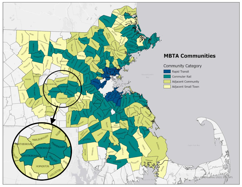
All of our directly neighboring towns, and most in our area, need to pass zoning to cover 50 acres. Like us, Westborough has to find 10 acres within the 1/2 mile of the station. But that requirement for our towns were halved to reflect stations near a border.
Ashland and Framingham have a full 1/2 mile radius around their stations to zone in, so they need to specify 20 acres within the circle. As for Ashland’s area near our station, the portion of their town within the 1/2 mile radius is mostly Hopkinton State park. (And since Ashland is less than half the size of Southborough in land acreage their overall required zoning represents a greater percentage of property.)
Multiple residents argued that because Southborough is negotiating an agreement to pipe MWRA water to them, the Town of Hopkinton should somehow be taking on some of our burden.
At the October 10th Select Board Meeting, Joe Palmer urged the board to try to negotiate better terms for Southborough. He opined that between Route 9 and the MWRA water pipeline, the small town of Southborough was already carrying an outsized infrastructure burden for the state.
Potential for Mixed Use Development
In a follow up discussion to the forum on October 10th, the Planning Board learned that the Economic Development Committee is looking into using the zoning initiative as an opportunity to add mixed use for properties next to Route 9.
The committee has been looking studying potential sewage infrastructure to help make the properties more attractive for business development. The hope would be that mixed use could help improve commercial vacancy rates.
*Updated (11/3/23 12:11 pm): I followed up with Colleen Stansfield who informed me the sessions are meant to cover all 50 acres of mapping, not just the “40 acres. . . beyond” highlighted on the flyer.
**Updated (12/13/23 9:30 am): At their December 11th meeting, Planning members said that the restrictions also require at least one parcel cover 25 contiguous acres.]
